Looking for design inspiration?   Browse our curated collections!

Previous Image

|

Next Image
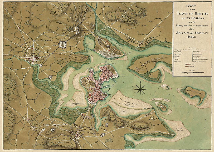
Boston Drawing - Antique Map of Boston Massachusetts by Thomas Hyde Page - 1776 by Blue Monocle

Antique Map of Boston Massachusetts by Thomas Hyde Page - 1776 is a drawing by Blue Monocle which was uploaded on February 19th, 2014.

More from Blue Monocle

View Profile

Antique Map of Boston by William Price - 1769 by Blue Monocle
Antique Map of Boston by Currier and Ives - 1873 by Blue Monocle
Antique Map of Boston Harbor by Thomas Wheeler - circa 1775 by Blue Monocle
Antique Map of Boston Massachusetts by John Bachmann - circa 1877 by Blue Monocle
Antique Map of Boston Massachusetts by Thomas Hyde Page - circa 1775 by Blue Monocle
Antique Map of Boston Masschusetts by H.H. Rowley and Co. - 1880 by Blue Monocle
Antique Map of Mount Desert Island and the Coast of Maine - circa 1900 by Blue Monocle
Antique Map of Boston Massachusetts by A.E. Downs - circa 1899 by Blue Monocle
Antique Map of Boston Massachusetts by Samuel Augustus Mitchell - 1863 by Blue Monocle
Antique Map of Boston - USGS Topographic Map - 1903 by Blue Monocle
Antique Map of Boston by William Faden - 1777 by Blue Monocle
Antique Map of Boston Massachusetts by F. Fuchs - 1870 by Blue Monocle
Antique Map of Massachusetts by R. Sayer and J. Bennett - 1775 by Blue Monocle
Vintage Map of Boston, Massachusetts, 1889, Blueprint Style by Blue Monocle

Comments (3)

Gull G

Gull G

Congratulations on your recent sale!

Sotiris Filippou

Sotiris Filippou

Congratulations on your sale !!

Celestial Images

Celestial Images

Congrats on your sale. Awesome work.

Recently Viewed

Antique Map of Boston Massachusetts by Thomas Hyde Page - 1776 by Blue Monocle
Previous Image Next Image