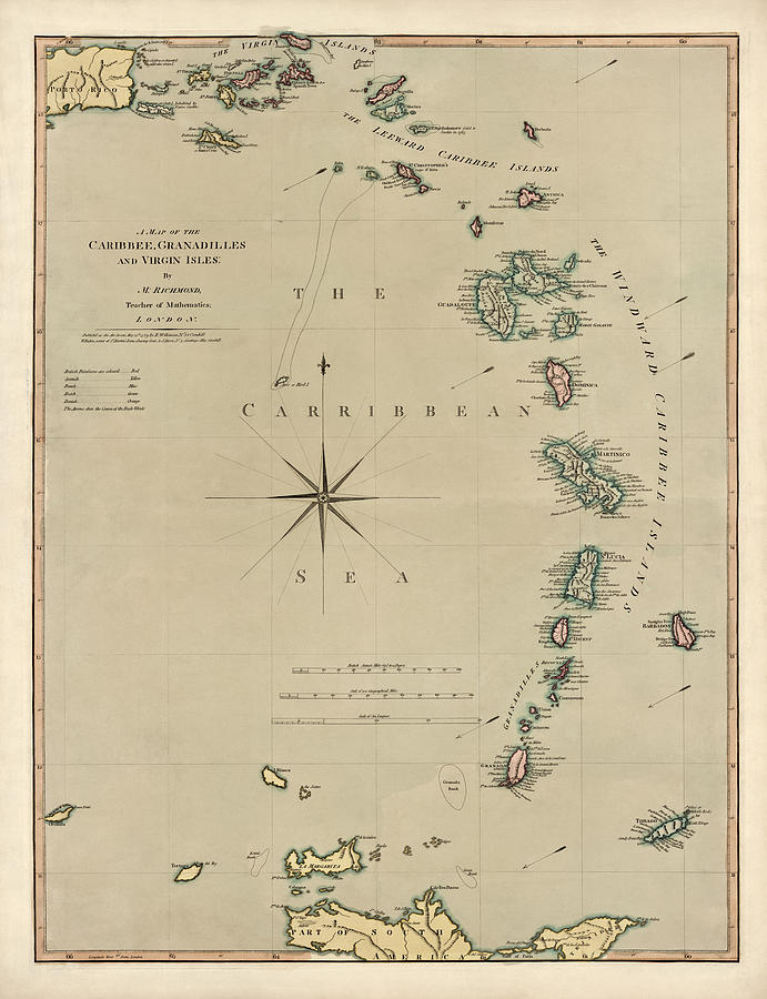
Antique Map of the Caribbean - Lesser Antilles - by Mathew Richmond - 1789 is a drawing by Blue Monocle which was uploaded on January 16th, 2014.
Antique Map of the Caribbean - Lesser Antilles - by Mathew Richmond - 1789
A late 18th-century map of the Lesser Antilles in the Caribbean, covering the region from the east coast of Puerto Rico south to the north coast of... more

by Blue Monocle
Title
Antique Map of the Caribbean - Lesser Antilles - by Mathew Richmond - 1789
Artist
Blue Monocle
Medium
Drawing - Engraving
Description
A late 18th-century map of the Lesser Antilles in the Caribbean, covering the region from the east coast of Puerto Rico south to the north coast of South America. Numerous place names on each island are included, and the coloring of each island indicates the country claiming possession, including Britain, Spain, France, Netherlands and Denmark. Original title: A Map of the Caribbee, Granadilles and Virgin Isles
Uploaded
January 16th, 2014


