Antique Map of the Upper Midwest US and Great Lakes by Benard - circa 1768 is a drawing by Blue Monocle which was uploaded on April 1st, 2014.
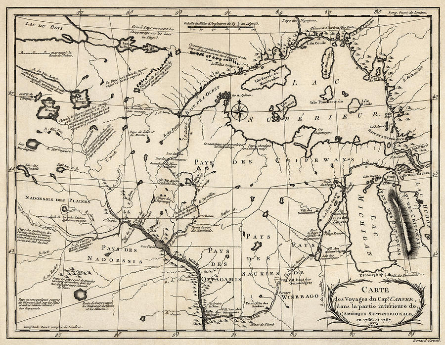
Antique Map of the Upper Midwest US and Great Lakes by Benard - circa 1768
Covers present day Minnesota, Iowa, Wisconsin, and Michigan, as well as Lake Superior and Lake Michigan. Contains numerous annotations in French... more

by Blue Monocle
Title
Antique Map of the Upper Midwest US and Great Lakes by Benard - circa 1768
Artist
Blue Monocle
Medium
Drawing - Engraving
Description
Covers present day Minnesota, Iowa, Wisconsin, and Michigan, as well as Lake Superior and Lake Michigan. Contains numerous annotations in French describing the various regions covered by the map. Also shows the names and locations of Native American tribes.
Original title: Carte des Voyages du Cape. Carver, Dans la Partie Intérieure de l'Amérique Septentrionale en 1766, et 1767 (Map of the Voyages of Captain Carver in the Interior Part of North America in 1766 and 1767)
Uploaded
April 1st, 2014


