Satellite Map Of Global Ozone is a photograph by Laboratory For Atmospheres, Nasa Goddard Space Flight Center which was uploaded on May 6th, 2013.
Satellite Map Of Global Ozone
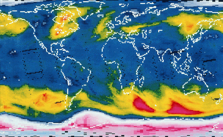
Satellite map of global ozone on October 2, 1987, showing the severe depletion or hole in the ozone layer over Antarctica. The hole is probably due... more
Title
Satellite Map Of Global Ozone
Artist
Laboratory For Atmospheres, Nasa Goddard Space Flight Center
Medium
Photograph
Description
Satellite map of global ozone on October 2, 1987, showing the severe depletion or hole" in the ozone layer over Antarctica. The hole is probably due to pollution of the atmosphere by chlorofluor- ocarbons (CFCs). First seen in 1980, the "hole" has grown in severity. It reaches a maximum in October, the Antarctic spring. It is visible here as the pink & white area covering the south polar latitudes (bottom). The colours represent Dobson units, a measure of atmospheric ozone; blue, yellow & red represent increasing concentration of ozone. The map was made from data obtained by the Nimbus-7 weather satellite."
Uploaded
May 6th, 2013
More from Laboratory For Atmospheres, Nasa Goddard Space Flight Center
Comments
There are no comments for Satellite Map Of Global Ozone. Click here to post the first comment.


